Jarabulus (Jarābulus)
Jarabulus (جَرَابُلُس / ALA-LC: Jarābulus, Aleppo dialect: Jrāblos; Cerablus) is a Syrian city administratively belonging to Aleppo Governorate, under the de-facto control of the Syrian Opposition. Jarabulus lies on the western bank of the river Euphrates. In the 2004 census, the city had a population of 11,570. The population has increased significantly during the Syrian civil war.
It is located north of Lake Assad, just south of the Syria–Turkey border and the Turkish town of Karkamış.
In the Bronze and Iron Ages, the archaeological site lying just north of Jarabulus (half of which is now in Turkey) was called "Karkemish", in Greek and Roman times the ancient name of the city was "Europos" (Εὐρωπός), which must have been at the origin of the modern form of the toponym Jerabis.
The original 18th century form of the toponym seems to have been "Djerabis", later found however as "Djeraboolos" or "Djerablus", probably deriving from Hierapolis (modern-day Manbij, to the southwest).
Being on the southern side of the Istanbul-Baghdad railway, Jarabulus became a border town with Turkey based on the Treaty of Lausanne in the aftermath of World War I.
Following the outbreak of the Syrian civil war, the Syrian opposition took it over, along with its border post with Turkey on July 20, 2012. However from early July 2013 the town was controlled by the Islamic State of Iraq and the Levant. By January 2014, rebels mainly from the al-Tawhid Brigade engaged in clashes with ISIL and seized the town, but ISIL was able to recapture it within hours.
An article published by The Guardian said that attempts by the People's Protection Units (YPG) to capture Jarabulus were prevented by President Recep Tayyip Erdoğan, who, according to media reports, had threatened in 2015 to attack the YPG using Turkish Armed Forces if they moved against Jarabulus. This threat secured ISIL control of the town.
Map - Jarabulus (Jarābulus)
Map
Country - Syria
 |
 |
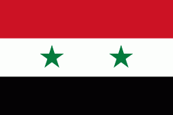
| Flag of Syria | |
The name "Syria" historically referred to a wider region, broadly synonymous with the Levant, and known in Arabic as al-Sham. The modern state encompasses the sites of several ancient kingdoms and empires, including the Eblan civilization of the 3rd millennium BC. Aleppo and the capital city Damascus are among the oldest continuously inhabited cities in the world. In the Islamic era, Damascus was the seat of the Umayyad Caliphate and a provincial capital of the Mamluk Sultanate in Egypt. The modern Syrian state was established in the mid-20th century after centuries of Ottoman rule. After a period as a French mandate (1923–1946), the newly-created state represented the largest Arab state to emerge from the formerly Ottoman-ruled Syrian provinces. It gained de jure independence as a democratic parliamentary republic on 24 October 1945 when the Republic of Syria became a founding member of the United Nations, an act which legally ended the former French mandate (although French troops did not leave the country until April 1946).
Currency / Language
| ISO | Currency | Symbol | Significant figures |
|---|---|---|---|
| SYP | Syrian pound | £ or لس | 2 |
| ISO | Language |
|---|---|
| AR | Arabic language |
| HY | Armenian language |
| EN | English language |
| FR | French language |
| KU | Kurdish language |


